Leaders: Suzanne Smith, Johan de Koker, Charlotte Augustyn
Sometimes on TV, when showing a dangerous activity, the audience will be warned not to try this at home. Well, don’t try repeating this meet with its many variables – an organisational nightmare! It became complicated because some members signed up for the full 4 days, others for only 2, and in different combinations! So bear with us as we tell you about it, because it was all worth it with this enthusiastic group…
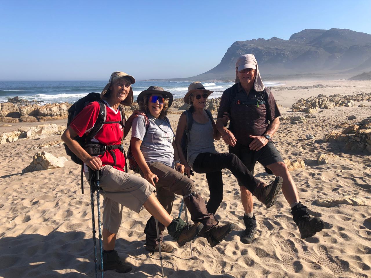
Monday 12: We heard only days before that Clarence Drive was to be closed completely, not just stop-and-go, in the exact week we needed to drive it! Nevertheless Ahmed and Suzanne decided to take the long detour via Bot River to visit Stony Point near Betty’s Bay. The 1 km boardwalk takes one past interesting information boards and past the resident African penguins to the end where we find 4 different types of cormorant, some feeding their young. After a tasty fish and chips lunch there at On the Edge Restaurant we left for Hermanus where Greta and Ludi joined us at our accommodation on the coast. Having settled in quickly the four of us drove to the New Harbour to start the Cliff Walk to Roman Rock about 4.5 km further along. From the Cliff Path we could see our planned route in Fernkloof (photo). Back home we welcomed Thandi and Kate who had just arrived, and later enjoyed our only full communal supper, (photos) expertly cooked by braai-master Ludi.
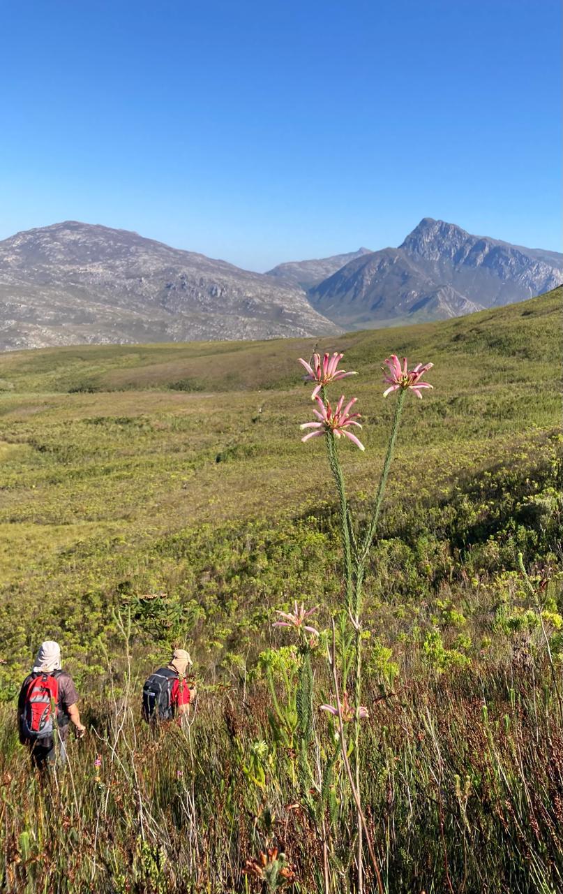
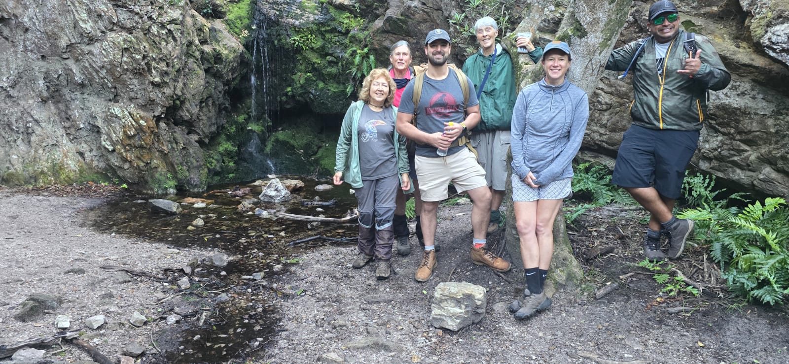
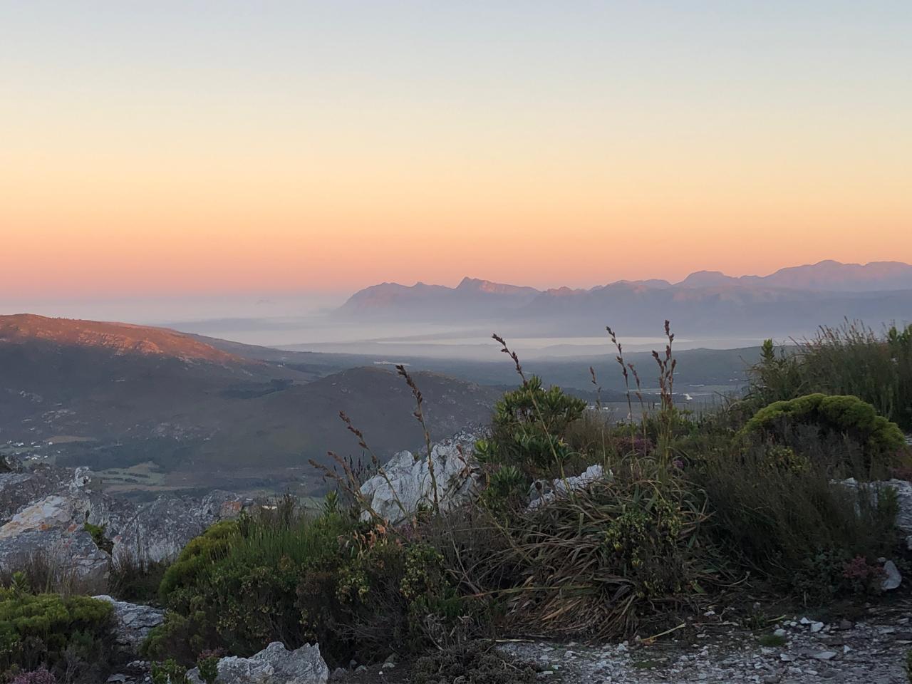
Tuesday 13:Today the group would split up, so Johan was co-opted to lead the day hikers while Suzanne led the overnight group. The full group started off from the kiosk in Fernkloof Nature Reserve, visiting the tiny waterfall via a path through a forest (photo), then on past Lemoenkop, up Adder Ladder, through Boekenhoutbos, past White Rock to the perfectly situated, tiny Galpin Hut. It is the time of year when the erica Galpinii should be flowering, but it has mostly been destroyed by past fires and we couldn’t find any, hard as we tried. Despite that disappointment, the fynbos was pristine and lush, and the changing views worthwhile. To the west, the Hemel en Aarde Valley and Babilonstoring, to the east Walker Bay, to the south Kleinmond and Kogelberg. And the weather was glorious!
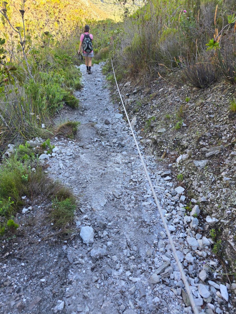
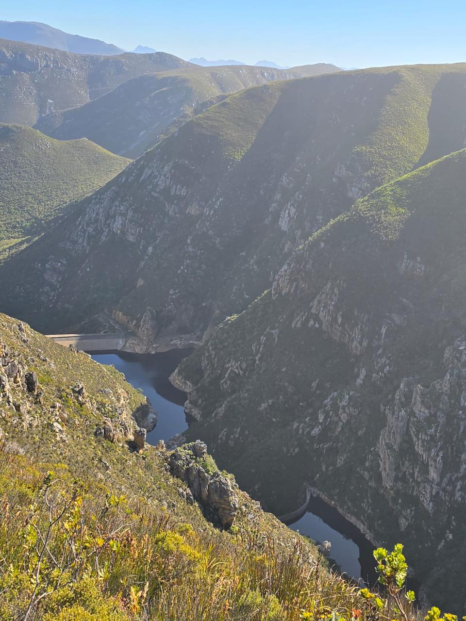
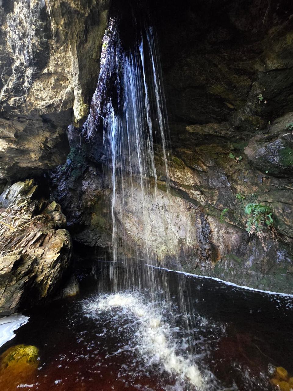
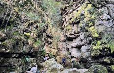
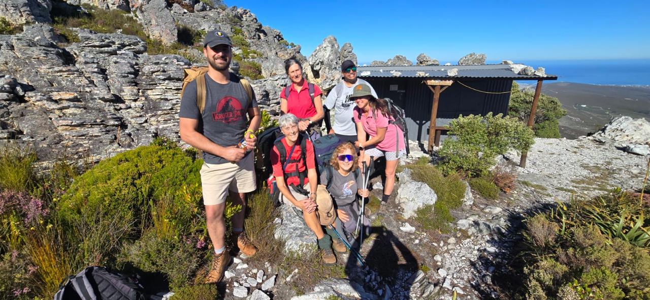
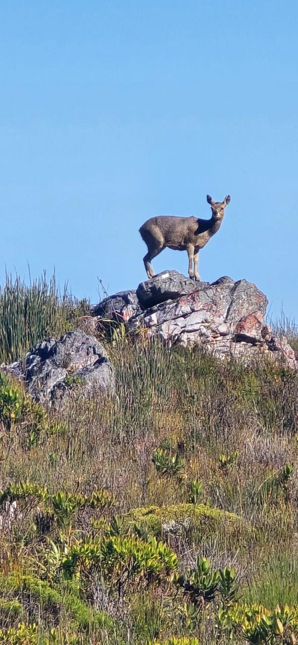
Approaching Galpin Hut we saw 2 klipspringer close by – always exciting (photo). At the hut we unlocked the door so that those not staying could see what they were missing and know what to expect should they plan to visit at another time – a maximum of only 4 at any one time can stay there. We took a group photo outside before Greta, Ludi and Suzanne waved the others on their way. Johan took the others to visit the very special, neatly tucked away, Cave Falls, where the Mossel River flows through the roof of the cave (photo). From there the path takes a lengthy necessary detour to bypass a huge, deep ravine before arriving at the exciting knife edge into Droekloof with the trio of Mossel River Dams on one side directly below (photos). A very useful rope has been secured along the side of the path below the knife edge (photo). Back around Lemoenkop to their cars. A total of about 14 kms for the day.
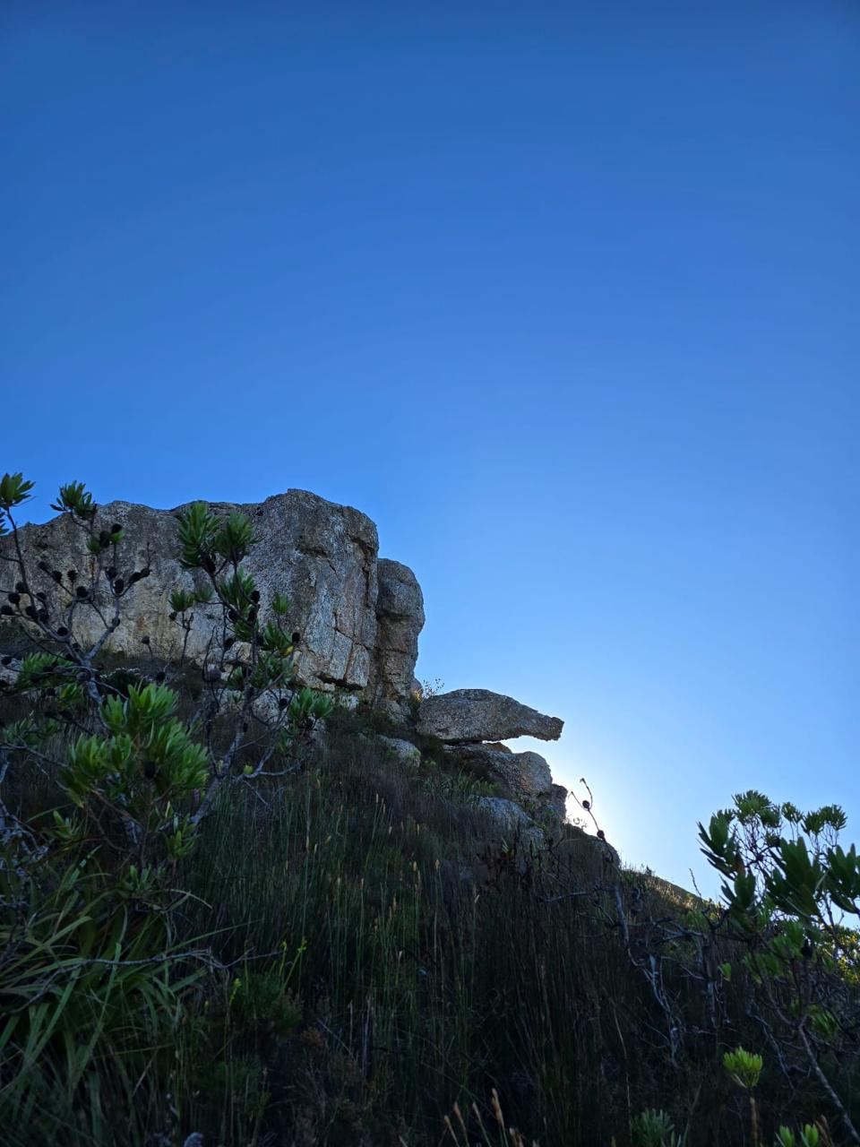
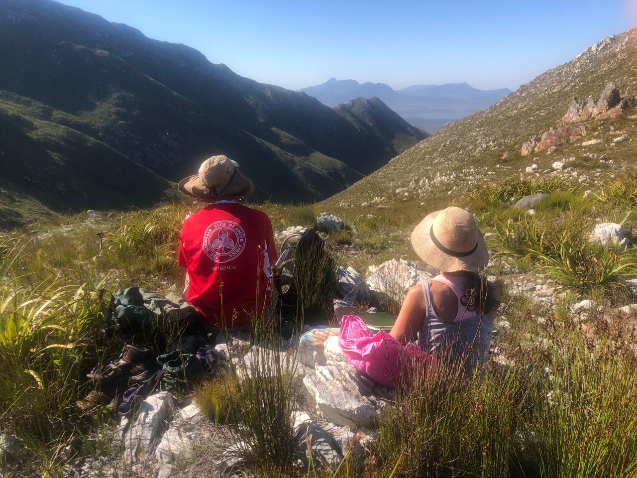
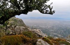
Meanwhile, the trio that were to overnight at the hut, transferred their lunch to a small day pack and set off towards Sculptured Corner. This route ascends gently from the hut around Platberg. Apart from the interesting rock formations we passed, the views of the valley to the west and the far-off mountains were pleasing (Photo). Past Kantoorkloof, near the turnoff to Aasvoelkop, the highest peak in the reserve at 824m, we tried to find the ‘service path’ referred to by Mike Lundy, which would take us on a ‘short cut’ over Platberg back to the hut. Although we could see the exit point of the tiny path at the lower end the next day, it was just not visible from the upper end, so we decided to retrace our outbound route back to the hut rather than opt for the longer outer route, part of which we would be crossing the next day anyway. Our afternoon route took us a total of 3 hours including a short lunchbreak and hunting for that path, making our total distance hiked that day about 11.5 km.
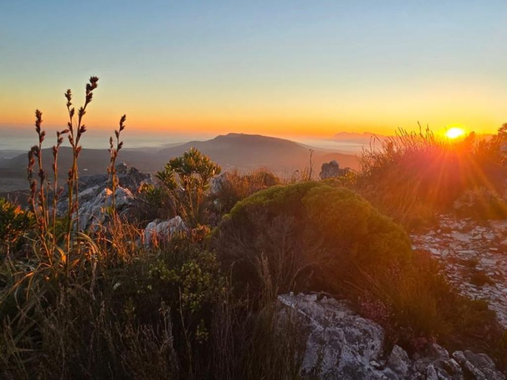
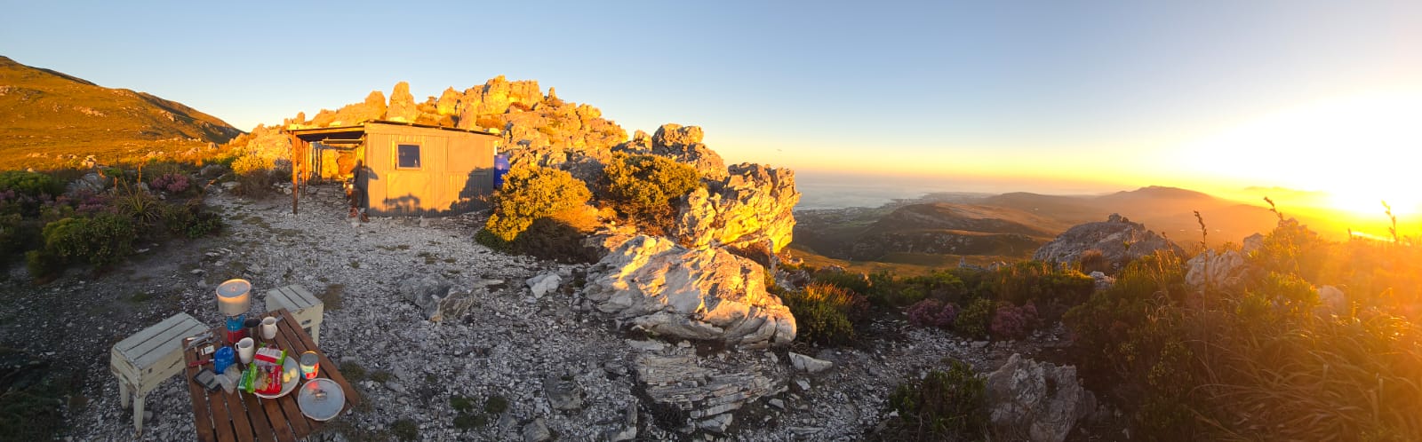
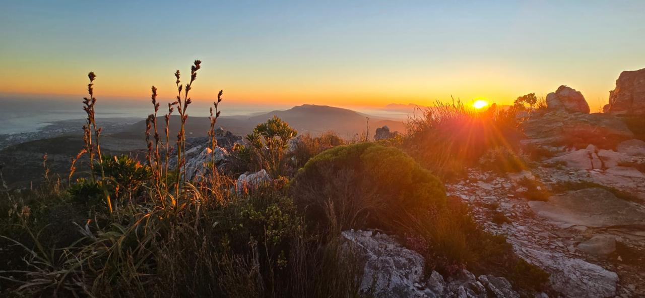
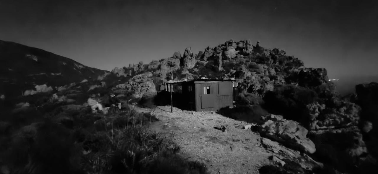
Back at the hut we settled in, relishing our peaceful surroundings, a mug of hot chocolate in hand. We decided to cook and eat our supper outside (photo), watching the glorious sunset on this mild, windless evening (photo). With the full moon up we could walk to the loo some distance away without headlamps because the path of white stones was so well lit by moonlight! We were in bed at 19:30! and up at 5:00 the next morning, walking around in the moonlight for the fun of it (photo) and watching the sky lighten preceding the sunrise (photo).
Wednesday 14: Another perfect weather day. After breakfast we were ready to leave the hut at 7:45 with a quick visit to the summit of Galpin Kop before taking exactly the same route as Johan’s group the previous afternoon: visiting Cave Falls, following the jeep track to the top of Droekloof, where we had our first sighting of baboons. After a snack stop overlooking Droekloof, we descended, rounding Lemoenkop, arriving at the cars at 12:45 having covered just under 9 km.
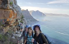
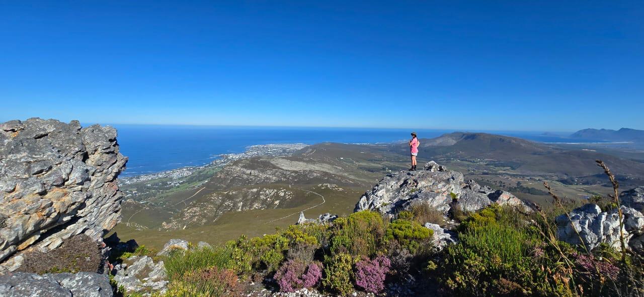
Meanwhile, the day hikers from the day before met Charlotte, our other leader and her 3 friends at the kiosk in Fernkloof. Ahmed, Thandi, Kate and Vivien, who had arrived the evening before, joined Charlotte in ascending to Kanonkop, named for a rock formation that exactly resembles a cannon (photo). They were fortunate to have no less than 2 sightings of klipspringer reasonably close by on their route this day. From there to the jeep track that could take them to the hut if taken further. They turned right and descended via the same route we had all ascended the day before, via Boekenhoutbos and Adder Ladder back to the cars. They arrived there minutes before the party from the hut having completed about 5.5 km.
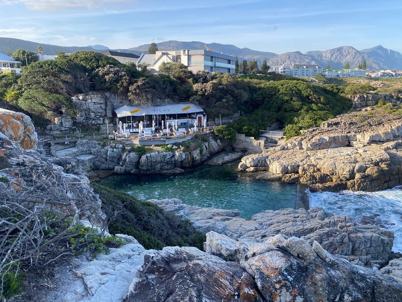
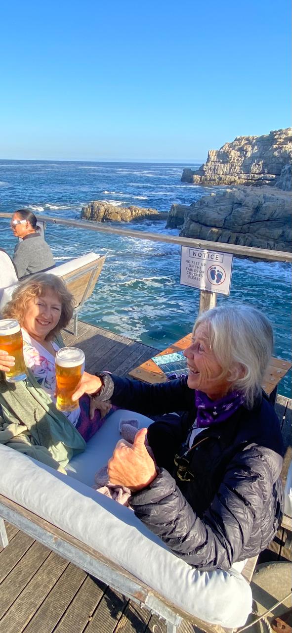
It was at this point that the group size began to shrink due to the 2-night option. Only 3 of us were left for our last night in the area. During the afternoon Greta and Vivien, who had not been with us on the Cliff Path on Monday decided to do a shorter version and visit Fick’s Pool (photos).
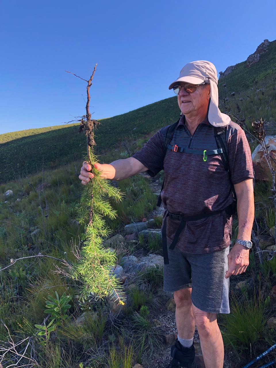
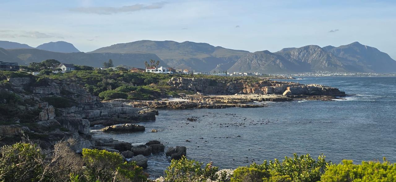
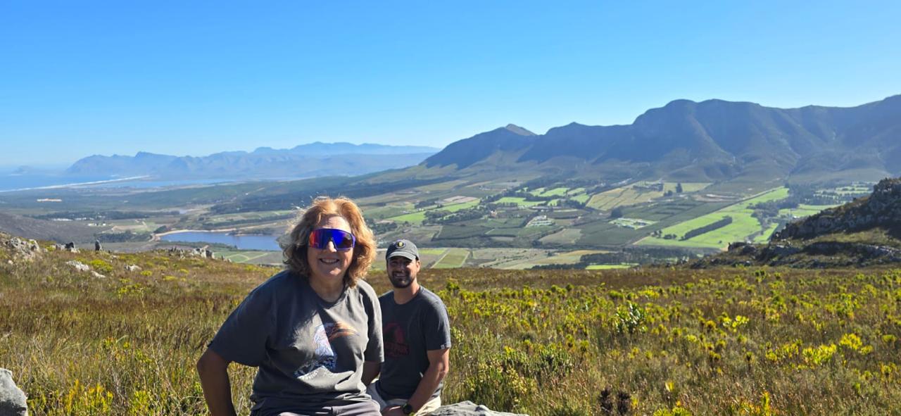
Thursday 15: We three drove to Kleinmond Harbour on this sunny morning to meet Johan as our guest for the day, parking our cars at the Golf Club for the start of our circular contour route. Sadly, due to a huge fire a few years earlier that wonderful experience of hiking through kilometres of tall Botrivier (compacta) proteas was denied us. Nevertheless the fynbos is pristine, plentiful, different and varied. We found exactly one alien – a small hakea which Johan managed to extract (photo). To our left we had Walker Bay as we walked along the slopes of the Three Sisters above on our right. The very vulnerable leucodendron platyspermum has been so harvested for floral arrangements that we only found one dead one along the way! Rounding the Three Sisters our views changed to the Palmiet River below and Kogelberg Reserve beyond. The path took us uphill to Spook Nek between the Three Sisters and Perdeberg, at which spot we stopped for lunch, enjoying yet more changed views (photos).
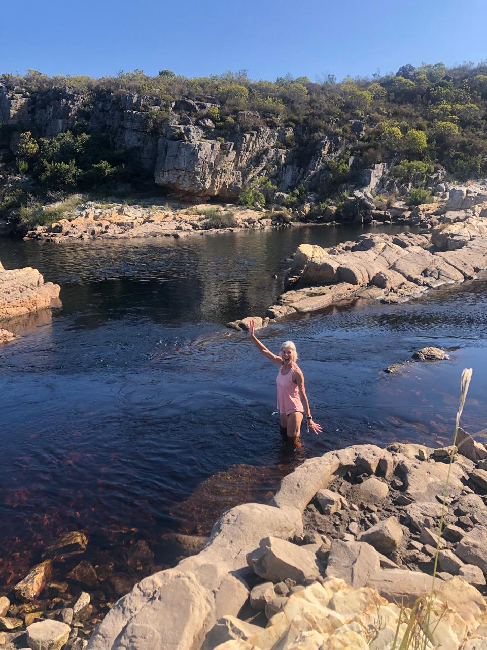
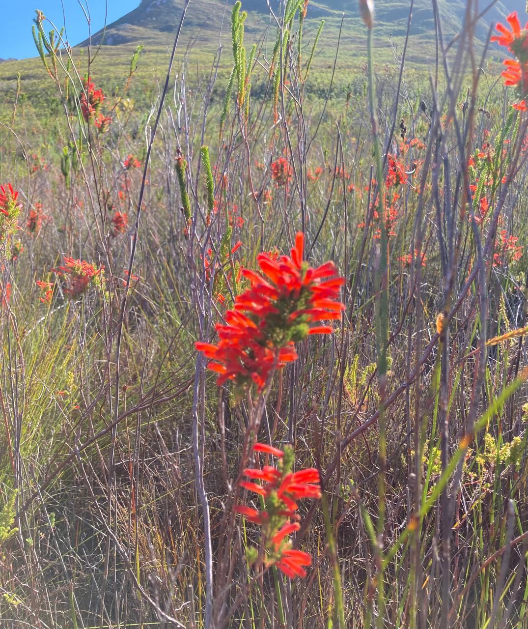
We had been warned not to expect to see erica Pilansii, endemic to that one small area! due to the harvesting that had taken place in late March. What a thrill therefore to see generous stands of this beautiful, bright red erica (photo) on our descent from Spook Nek! We continued our descent through Feetjiesbos to the Palmiet River where we stopped for an afternoon snack, and Greta and Vivien bravely dipped into the freezing cold water. From there the path follows the river bank before veering inland until the coast is reached. The boardwalk along the coast brought us to our car parked at the harbour, from there to fetch the other car parked at the Golf Club. We had covered about 11 km today.
And there our ways parted once again: some returning home and others remaining for our last night in Hermanus.
Hopefully the few selected photos give an idea of the trip in this beautiful area.